
Driving the Coronado Scenic Trail Byway, Arizona
THE CORONADO SCENIC BYWAY IN ARIZONA RUNS THROUGH THE APACHE-STIGREAVES NATIONAL FOREST. IMAGE: ©Jorn Vangoidtsenhoven, VANGO PHOTOS.
TTEAM MEMBER Jorn Vangoidtsenhoven, Vango Photos.
by Jorn Vangoidtsenhoven
Originally from Belgium, Jorn and his wife now live in Arizona. Jorn is a BI Analyst by trade and a wildlife and nature photographer by love. He and his camera have traveled the globe. His lens is set for now on the western hemisphere. This is his first report for Destination: Wildlife. Welcome, Jorn!
✓ Trip Tips
Who: Not up to a 116 mile hike? This is an extraordinary road trip.
What: A Designated National Scenic Byway. Unforgettable.
Where: Arizona, Coronado Scenic Trail Byway.
When: All year. Beware during inclement weather. Road is not regularly plowed in snow.
How: Self drive.
Secret: This is/ a Mexican grey wolf release area, listen for howls!
Editor’s Note: Back when our American west was more conjecture than conclusion, the young Francisco Vasquez de Coronado, famous (or infamous?) Spanish explorer and newly appointed governor of Nueva Galicia, (today the Mexican states of Jalisco, Nayarit and Sinaloa), lead an expedition up Mexico’s western coast and north across what is now the Arizona /New Mexico border. Coronado, inspired by stories of golden cities, was accompanied by an army of Spaniards plus native Americans, and assorted pigs, horses, cattle, and who knows what else.
Cordoba and his entourage did not find golden cities. But this area was, and is, part of the true riches of the high desert. Riches that are still there for us to explore, today. Our good friend Jorn Vangoidtsenhoven follows in the expedition’s 400-year old footsteps. Here is Jorn’s report:
SPOTTING WILDLIFE FROM YOUR CAR WINDOW IS RELATIVELY EASY ON THE CORONADO SCENIC BYWAY. THIS DEER IS PROBABLY A COUSE WHITETAIL IMAGE: ©Jorn Vangoidtsenhoven, VANGO PHOTOS.
The Coronado Scenic Byway is a spur of the highway, US 191, that runs from the Mexican to the Canadian Boarder. The spur stretches 123 miles (198 km) total from Springerville to Clifton, Arizona. It is an amazing 2-lane rollercoaster with 460 dipping, winding curves and switchbacks, and few or no shoulders, along a steep cliff. About 4 miles (6.5km) south of Hannagan Meadow, it includes one of the highest points in Arizona, 9,370 ft (2,743m). It also includes unparalleled vistas and assorted wildlife that cross the road. Be prepared to stop. This is a Road-Less-Traveled, not those in a hurry. Relax and enjoy the ride!
Tracing Coronado’s Path From Morenci to the White Mountains of Arizona
“AS FAR AS THE EYE CAN SEE” GAINS NEW MEANING ON THE CORONADO SCENIC BYWAY, ARIZONA . IMAGE: ©Jorn Vangoidtsenhoven, VANGO PHOTOS.
ARIZONA’S CORONADO SCENIC BYWAY RUNS NORTH/SOUTH. MAP THANKS TO US Dept of Transportation FED. HIGHWAY ADMIN.
The Legend of The Seven Golden Cities
Legend has it that Francisco Vasquez de Coronado travelled this route through Eastern Arizona in 1540. As the Spanish conquistador was looking for the fabled “Seven Cities of Cibola”, he and his army of 1,100 men passed through the current mining town of Morenci into the White Mountains.
After a long journey, Coronado ended up in the small pueblo of Cibola in modern day New Mexico. The expedition was deemed a failure as he never did find the golden cities.
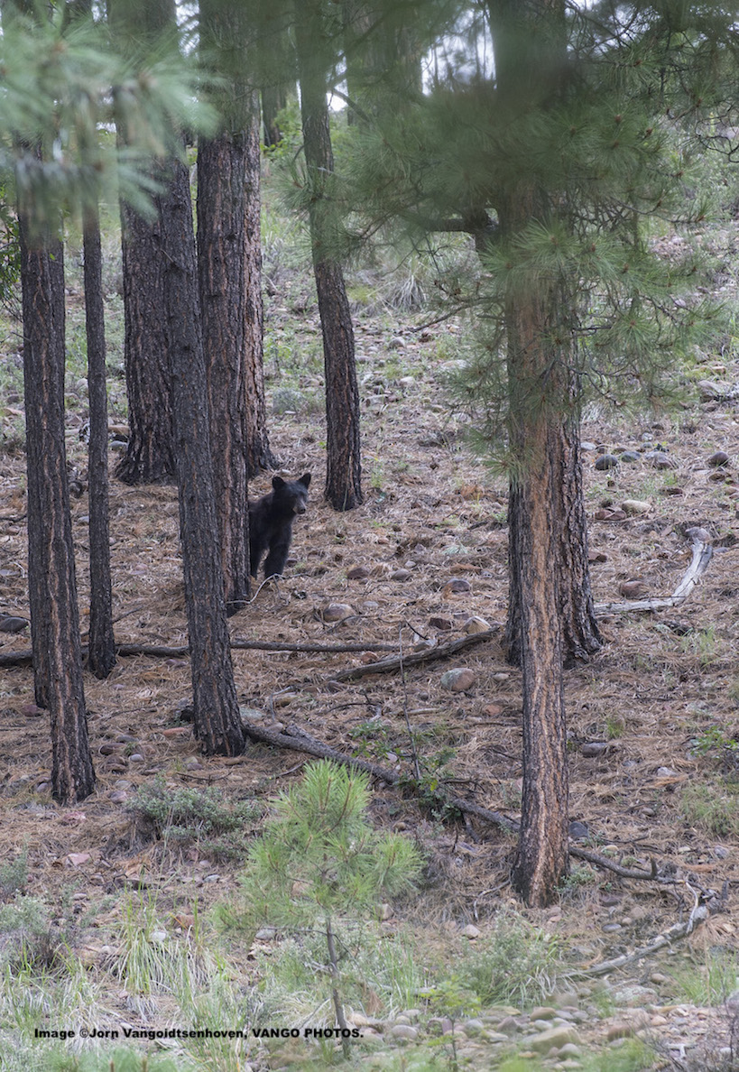
BLACK BEAR IS ONE OF THE WILDLIFE SPECIES THAT CALL THE APACHE-SITGREAVES NATIONAL FOREST “HOME.” IMAGE: ©Jorn Vangoidtsenhoven, VANGO PHOTOS.
DO YOU KNOW IF THIS IS AN ENDANGERED MOUNT GRAHAM RED SQUIRREL? PLEASE CONTACT US. IMAGE: ©Jorn Vangoidtsenhoven, VANGO PHOTOS
The “Devil’s Highway” Becomes a Scenic Byway
Our journey on the “Coronado Scenic Trail Byway” is 116 miles (187 km) and by car takes only 4 hours - today. But this road, as we currently know it, started its life back in 1926 as a one-lane [unpaved] forest road. It took an entire day to travel from Morenci to Springerville.
In 1928 the Arizona Highway Department took control of the road and changed the name first to Route 81 and later US Route 666, nicknamed the “Devil’s Highway”. The road was paved by 1962. It received its current designation of US 191 in 1992.
Depending on which direction you’re heading, our journey starts in either Morenci or Springerville. The difference in altitude between the two small towns is 5,000 feet (1524m.) Most of the scenic drive passes through the Apache-Sitgreaves National Forest. [Editor’s Note: Jorn followed South/North: Morenci to Springerville]
BUTTERFLIES, LIKE THIS BEAUTIFUL ATLANTIS FRITLLARY, ARE ABUNDANT IN THE WHITE MOUNTAINS. IMAGE: ©Jorn Vangoidtsenhoven, VANGO PHOTOS.
Cool Mountains, Hot Deserts and Wildlife!
Prepare for cool mountain temperatures in the White Mountains and hot desert temperatures in Morenci! Wildlife is plentiful in this remote corner of Arizona and varies depending on the climate zones as you make your way into the mountains. You have a good chance of seeing elk, deer, antelope, bighorn sheep, black bears, coyotes, turkeys, ospreys and golden eagles. Cell phone reception is spotty at best so be prepared the case of an emergency. Get ready to follow in Coronado’s footsteps and enjoy some of Arizona’s great scenery and wildlife!
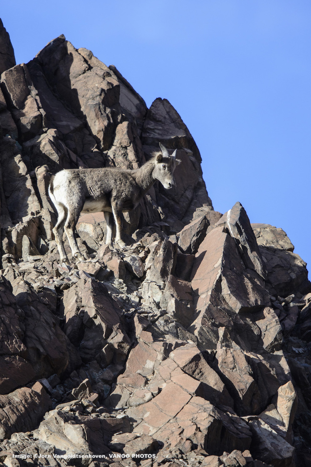
ROCKY MOUNTAIN BIGHORN SHEEP AWEIGH UP TO 340 LBS (154KG) . BOTH MALES AND FEMALES HAVE HORNS. IMAGE: ©Jorn Vangoidtsenhoven, VANGO PHOTOS.
Wild Beauty and The Mine, Morenci, Arizona
Morenci sits at an altitude of 4,080 feet (1244 m) and as a result, suffers under the intense summer heat of Southern Arizona with daytime highs usually exceeding 100F (38C) from June through September. The town owes its existence to the vast amount of copper in its surroundings, one of the largest copper reserves in the world. The Detroit Copper Company started mining here in 1872 and as the population grew, the town was founded in 1875. Today, the mine employs roughly 3,300 people.
THE BEAUTIFUL VISTA BEFORE ENTERING MORENCI. IMAGE: ©Jorn Vangoidtsenhoven, VANGO PHOTOS.
What is surprising about this town located in the Arizona desert with all this mining activity (including almost daily dynamite blasting), is that there is a sizable population of Rocky Mountain bighorn sheep living here.
THE SCENE AFTER ENTERING THE MORENCI AREA, THIS COPPER MINE HAS BEEN ACTIVE SINCE 1872. IT BALSTS DAILY. IMAGE: ©Jorn Vangoidtsenhoven, VANGO PHOTOS.
Different from the Desert bighorn sheep that are prevalent in Arizona’s southern deserts, Morenci’s sheep are the same species you may encounter in the Rocky Mountains of, let’s say Colorado, Montana or the national parks of British Columbia and Alberta, Canada. The dusty desert environment doesn’t provide the sheep with many grazing opportunities or cover from predators.
The easiest places to find and photograph the sheep are lawns in front of homes or in the neighboring town of Clifton where the sheep can often be found grazing on the baseball field or in front of the old train depot. If you’re lucky, you’ll spot the sheep clinging to the steep cliffs surrounding town which makes for a great photo opportunity.
ROCLY MOUNTAIN BIG HORN SHEEP BLEND PERFECTLY INTO THE ROCK CLIFFS ALONG THE ROAD. IMAGE: ©Jorn Vangoidtsenhoven, VANGO PHOTOS.
ANNAS HUMMINGBIRD. IMAGE: ©Jorn Vangoidtsenhoven, VANGO PHOTOS.
The sheep are a local tourist attraction and a fitting start to the Coronado Trail’s appeal. Pay attention while driving as the sheep often cross the highway. In recent years, 200 sheep have been killed by vehicles.
The local sheep population is so large and healthy that the Arizona Game and Fish Department captures the surplus of sheep to establish new herds in historic habitat elsewhere and to add to existing herds that are below desired population levels.
CLIMB INTO THE MOUNTAINS
As you leave Morenci, the road immediately twists and turns into the mountains. Deer are plentiful and can often be seen near the road. There are several viewpoints to gaze out over the desert landscape as far as the eye can see.
THE BLUE RANGE PRIMITIVE AREA, PART OF THE APACHE-SITGREAVES NATIONAL, IS THE FINAL DESIGNATED PRIMITIVE AREA IN THE NATIONAL FORESTRY SYSTEM. IMAGE: ©Jorn Vangoidtsenhoven, VANGO PHOTOS.
The Blue Range Primitive Area, A Mexican Grey Wolf Release Site
The road continues along into the higher elevations and passes by the “Blue [Range] Primitive Area”. Eleven Mexican wolves were released into the wild here in 1998. Subsequent releases have continued to occur and today the population is thriving. Protected under the Endangered Species Act, the wolves roam the vast area along the Arizona – New Mexico border. Wolves are typically very shy but they have been spotted along the Coronado Trail, for example near the town of Alpine. Consider yourself very lucky to hear their nighttime howls or to encounter one. You have a much greater chance of hearing the nightly serenades by the many coyotes that inhabit the wilderness.
IN THE AUTUMN THIS IS A GOOD PLACE TO HEAR NORTH AMERICAN ELK BUGLING TO GATHER THEIR HAREM. IMAGE: ©Jorn Vangoidtsenhoven, VANGO PHOTOS.
Hannagan Meadow, Arizona
BIG MALE ELK COVERED IN MUD. MALES CAN GROW TO 1200 LBS (544KG) ©Jorn Vangoidtsenhoven, VANGO PHOTOS.
North of Morenci, the first sign of civilization is at Hannagan Meadow, named after Nevada miner Robert Hannagan. Nothing more than a small gas station and a lodge, you now find yourself in the cool mountains. The surrounding spruce-fir forests are a great place to escape the brutal desert summer heat, enjoy spring wildflowers, fall colors or simply find peace and quiet in nature.
The Forest Comes Alive with Bugling Elk
In fall, the forests surrounding Hannagan Meadow and the nearby town of Alpine come alive with the sounds of bugling elk. The annual fall elk rut is a spectacle to behold as the big bulls compete for breeding rights with the female cows.
Best places to find and photograph them around the trail are large meadows during dusk and dawn. The White Mountains are a good breeding ground as the local elk bulls grow to be some of the largest in the world!
SHORTER DAYS SIGNAL THE RUT. THE MALE’S BUGLING BRINGS FEMALES OUT OF THE FOREST AND INTO THE MEADOW WHERE HE CAN ROUND THEM UP TO FORM HIS HAREM. IMAGE: ©Jorn Vangoidtsenhoven, VANGO PHOTOS.
Springerville
Your last great chance for observing wildlife along the Coronado Trail is the “Sipe White Mountain Wildlife Area”, just south of Springerville.


Coronado Found the Riches
As you leave the forests and reenter civilization, you may feel the desire in your heart to turn around and head back onto the trail. Bugling sounds that echo through the mountains, big horn sheep head-butting between the giant mining equipment, the ability to choose the weather by heading up or down the trail: Coronado had a point by choosing this route!
Many thanks to Jorn Vangoidtsenhoven, Follow him on Facebook


MORE
American West
Slippery Ann’s Amazing Bugling Elk Charles M. Russel Wildlife Refuge, Montana
How to Photograph the Soul of the Forest, Safely Kabetogama State Park, Minnesota
7 Days Photographing the Most Majestic Parks in America
Yellowstone & Grand Teton National Parks, Wyoming
8 Magic Places to See Wolves in the Wild Assorted destinations in the US and abroad


